
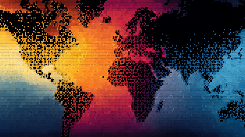
Google DeepMind has recently introduced a new artificial intelligence tool called AlphaEarth Foundations. It’s being called a “virtual satellite”, and it’s designed to give us a smarter, faster, and more complete view of what’s happening on our planet.
This isn’t just a tech update. It’s a major breakthrough that could help solve real-world problems like crop failure, forest loss, climate change, and more.
Let’s understand what this tool is, how it works, and why it matters.
What is a “Virtual Satellite”?
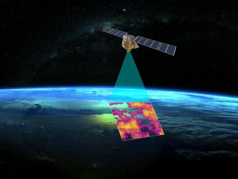
Usually, when we think of satellites, we imagine machines in space capturing images of Earth. These satellites collect huge amounts of useful data – about weather, land, water, forests, and many other things.
But there’s a challenge.
The data is often scattered across different platforms, collected by different organizations, and stored in different formats. That makes it difficult to use the data effectively and quickly.
This is where AlphaEarth Foundations comes in.
It combines data from thousands of real satellites and Earth observation systems into a single, smart AI model. Instead of just showing raw satellite images, it creates a detailed, understandable, and constantly updating view of the Earth.
In simple words, it brings together all satellite information into one system that learns and improves with time.
Why This is a Big Deal
We are living in a time where we need faster decisions to deal with environmental challenges. Deforestation, crop damage, floods, droughts, and other climate-related problems are growing every year.
We already have the data to understand these issues. The problem is, we often don’t have the right tools to make sense of that data in time.
AlphaEarth Foundations changes that.
It doesn’t just collect information. It helps us understand what is going on, almost in real-time. For example:
- It can detect crop health issues before they become serious.
- It can monitor deforestation as it happens.
- It can help predict drought or flood situations early.
- It can offer an environmental report of any place on the planet.
By giving this kind of insight, AlphaEarth can help farmers, governments, scientists, and disaster management teams take action faster and more accurately.
How It Was Built
AlphaEarth Foundations was trained using years of satellite and environmental data. This includes information about land types, water levels, weather patterns, and vegetation.
But it’s not just a map. It’s an intelligent system. It can learn from patterns, make predictions, and even highlight future risks.
This makes it useful for many areas:
- Agriculture planning
- Forest protection
- Water management
- Climate research
- Emergency preparedness
In short, AlphaEarth is a new way of watching, understanding, and protecting the planet. And it could be one of the most powerful tools for fighting climate change and environmental damage.
How AlphaEarth Foundations Works and Who It’s For
Now that we understand what AlphaEarth Foundations is, let’s explore how it actually works and who stands to benefit the most from it.
How Does AlphaEarth Work?
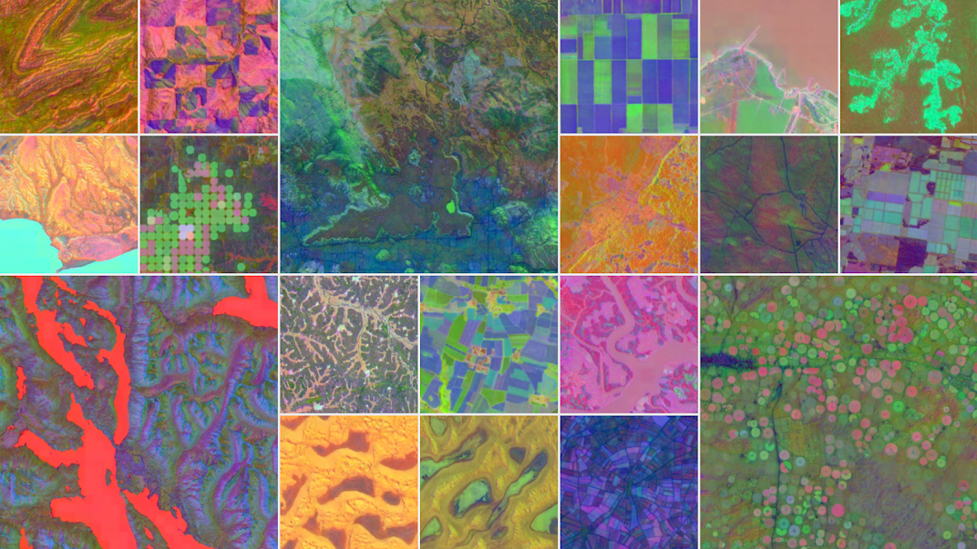
AlphaEarth Foundations is powered by advanced machine learning models developed by Google DeepMind. These models are trained on a wide range of Earth observation data. This includes:
- Satellite images
- Weather data
- Vegetation indices
- Soil and water maps
- Temperature and humidity readings
- Geographic and topographic data
The system brings all of this together and continuously learns from it, improving its understanding of the Earth’s surface over time.
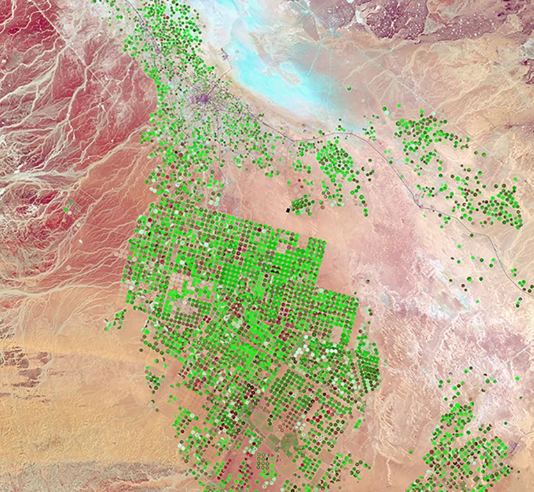
For example, if a certain region is showing drying soil patterns, reduced vegetation cover, and rising temperatures, AlphaEarth can identify that as an early sign of drought — sometimes weeks before it becomes visible to the human eye or traditional models.
Designed to Help Real-World Problems
This AI system isn’t built just for research labs. It’s designed for practical use in the real world. Here’s how different sectors can benefit:
1. Farmers and Agriculture Planners
AlphaEarth can provide early warnings about crop health, water shortages, or soil conditions, helping farmers plan their actions better. In many regions, this could be the difference between a successful season and total loss.
2. Governments and Policy Makers
Real-time updates about floods, droughts, or forest loss help officials make faster decisions for resource allocation, relief measures, or disaster response.
3. Environmentalists and Forest Managers
AlphaEarth can detect illegal deforestation or land misuse early, even in remote forests. It offers detailed records of how land is changing over time.
4. Climate Researchers
Instead of manually combining multiple satellite data sets, scientists now have a single system that provides a clean, updated, and AI-enhanced view of global environmental patterns.
A Smarter Eye on Earth
The biggest strength of AlphaEarth is not just its data, but its ability to learn patterns, understand context, and highlight risks — before the damage is done.
Google says the project is still in development, but early results are promising. The tool could eventually be integrated into public services, emergency systems, weather apps, and climate monitoring tools worldwide.
The Future with AlphaEarth Foundations
AlphaEarth Foundations is more than just a new AI tool from Google. It shows us what’s possible when technology and nature work together.
This tool is not meant to replace people — it’s built to support decision-makers, protect nature, and prepare for the future.
Helping in Emergencies
Natural disasters like floods, droughts, and wildfires are happening more often. Usually, by the time we know the damage is coming, it’s already too late.
But with AlphaEarth:
- Flood risk can be predicted early
- Drought signs can be seen before crops fail
- Forest fires can be tracked in real-time
This kind of fast and smart response can save lives, save money, and reduce damage.
Better Planning for Climate Change
Climate change is not just a future problem — it’s already affecting millions of people. AlphaEarth Foundations gives us the tools to:
- Track how weather and land are changing
- Monitor the health of forests, rivers, and farmlands
- Plan better for future risks
By using this AI, countries can make stronger climate policies, based on real-time facts — not just guesswork.
Making Environmental Education Stronger
AlphaEarth could also help students and teachers. It can show how nature works, how humans impact the planet, and what we can do to protect it.
For schools, colleges, and even local training centers, this tool can become a live Earth classroom.
Imagine learning geography, farming, or climate science by looking at real-time Earth data — that’s the power of this technology.
Final Thoughts
AlphaEarth Foundations is still new, and it will take time to reach every corner of the world. But it shows a strong step forward.
With the help of AI, we now have the chance to:
- Understand our planet better
- Act faster in emergencies
- Plan smarter for the future
Google DeepMind has created a tool that can truly help protect Earth. And if used wisely, it can bring major change in how we care for our environment.